- How do I get to the High Coast Trail?
-
The High Coast Trail can be hiked in both directions, which means there are two starting points: Hornöberget and Örnsköldsvik. At the start at Hornöberget, there is a large parking area where passenger cars can be left free of charge for up to 24 hours. For parking longer than 24 hours, a daily fee provided by Hotell Höga Kusten applies, and it is paid at the hotel reception. To find out more about the fee, contact Hotell Höga Kusten. You can also get here by public transport. Bus number 50, which runs between Härnösand and Örnsköldsvik, stops at the Hornöberget E4 bus stop, about 400 metres from stage 1 of the High Coast Trail. The bus also stops in Ullånger, Docksta, Naturum Höga Kusten E4 by Skuleberget and at the Skule Entré V E4 stop, which is near the West Entrance. Line 421 between Köpmanholmen and Örnsköldsvik is also a popular route among hikers. The start in Örnsköldsvik is located at Stadsträdgården, and you can travel to Örnsköldsvik by train or bus. Y-buss line 100 also stops at Hornöberget, Ullånger and Docksta. In addition to the parking at Hornöberget, free parking is available at almost all stage starts, including all three entrances to Skuleskogen National Park. If you want to start your hike from Örnsköldsvik, there is paid parking at the travel centre.
GPS coordinates for the start at Hornöberget and in Örnsköldsvik.
Current bus timetables can be found at www.dintur.se. For questions about the buses, contact DinTur at +46(0)771-100 110.
- Is there a hiking guide or map to buy?
-
We do not have any hiking guides or maps of the High Coast Trail.
- Where can I find maps of the High Coast Trail?
-
On this page, hogakusten.com/hogakustenleden, you will find up-to-date maps. Also download the High Coast app from the App Store or Google Play Store for up-to-date maps. You can also find maps on Naturkartan.se and in their app.
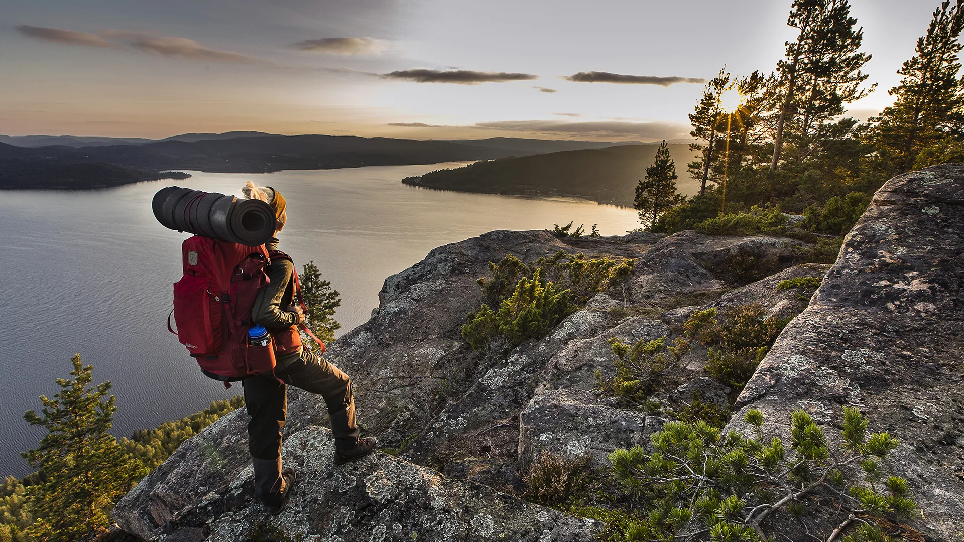
- What is the smartest way to pack?
-
Hiking does not really require much specialist equipment, but there are a few things to keep in mind to make the experience as comfortable as possible.
First and foremost, think about what kind of person you are and what you believe you absolutely cannot manage without. But you know what? You will manage without it! Hiking is about being in the moment, here and now, and taking in all the beautiful things you see around you. Then the only important things are that you have comfortable clothes and shoes, that your pack feels comfortable to carry, and that you feel confident you have something to eat and drink when you need to top up your energy. Still, a camera/mobile phone to document your experiences is nice to bring along.
Find your way
Map, compass, waterproof map case, headlamp and GPS.
For documentation & passing the time
Pen, notebook and an exciting book.
Accommodation & sleeping
Tent, sleeping mat, small sitting pad, sleeping bag, pillow, headlamp plus extra batteries and a tent lantern.
Walking & carrying
The backpack must be comfortable to carry, preferably adjusted to your back length so that it fits well. If you are out on a day hike or will be sleeping in a hostel, the backpack should not be larger than a maximum of 30 litres. If, on the other hand, you are heading out for a weekend trip and need to bring a sleeping bag, tent and food, these should fit in a backpack of no more than 50 litres. Backpack, sleeping bag and tent should ideally weigh no more than 3 kilos together, as the weight of food and other items will be added. Distribute the weight correctly by placing heavier items close to your back. In addition to a backpack, a backpack rain cover, packing bags and hiking poles are good to have.
For unexpected visitors
Mosquito net / mosquito hat, mosquito repellent, tick remover.
Eating & cooking
Water bottle, camping stove (burner and pots), fuel, fire steel/matches, knife, kuksa/cup, cutlery, small whisk, pot gripper, washing-up liquid, dish brush, freeze-dried food, multi-tool, coffee and/or tea, salt and pepper, energy snacks (for example dried fruit and nuts), rubbish bag.
Shoes & socks
Well-worn-in outdoor trainers or running shoes work very well for day hikes with a lighter backpack. Waterproof shoes or Gore-Tex material are recommended for wetter days. If you are hiking longer distances and carrying a heavier backpack, a pair of lighter hiking boots is recommended to provide greater stability and better ankle support. Many hikers prefer to wear two layers of socks - a thin liner sock and a slightly thicker outer sock - to avoid blisters. Sports socks that fit the foot well and do not slip down are also preferable.
Clothing
Applying the layering principle is a good idea, where the innermost layer should keep you warm and wick moisture away from the body (wool or synthetic material). The mid-layer should move moisture further out while retaining warmth (wool or fleece). The outer layer should protect against wet and wind while also providing warmth. Some garments could include a base-layer top (long sleeve), base-layer top (short sleeve), long johns, underwear (briefs, sports bra, underpants), wool socks (thin + medium-thick), hiking trousers, warm sweater (fleece or wool), airy shirt in a technical material, hat and/or buff, windproof gloves, rain jacket and rain trousers, waterproof packing bag for underwear, swimwear.
Patch & repair
Needle, thread, duct tape, multi-tool, steel wire, thin cord that can also be used as a clothesline, repair patches for the tent and possibly an inflatable sleeping mat.
Hygiene & first aid
First-aid kit, toothbrush and toothpaste, blister plasters, Alvedon, toiletry bag, quick-drying towel, toilet paper, soap, sunscreen.
When you reach civilisation
Wallet, mobile phone, sunglasses, binoculars, waterproof packing bag for electronics.
-
Where can I refill water along the High Coast Trail?
-
There are several places along the High Coast Trail where you can refill with water.
Stage 1, Hornöberget - Lövvik
You can refill water bottles in the café at Hotell Höga Kusten at Hornöberget. Inside the men's toilet in the building outside, there is a water tap.
Stage 2, Lövvik - Gavvik
In the guest harbour in Lövvik, there is a water tap at Sjöbodviken guest harbour. Natural water sources are available at Hamntjärnen, Grönviksfjärden, Nördomstjärnen and Lidebro. At Hörsångs Camping, you can refill from a tap.
Stage 3, Gavik - Lappudden
On stage 3, you can refill from the water tap outside Gavikstorpets Bed & Breakfast and Lappuddens Friluftscenter.
Stage 4, Lappudden - Ullånger
At Ringråberget, there is a natural water source.
Stage 5, Ullånger - Skuleberget
In Ullånger, there is a petrol station and grocery store where you can refill water from a tap. In Docksta, there are also shops, restaurants and hotels where you are allowed to refill. At Docksta Vandrarhem och Camping in Skoved, you are also allowed to refill water. At FriluftsByn and naturum Höga Kusten, you can also refill water.
Stage 6, Skuleberget - Köpmanholmen
At Skuleberget's seaside campsite, you can refill water. After that, you pass Skuleskogen National Park, where there are several natural water sources and streams. Both at the south entrance and the north entrance.
Stage 7, Köpmanholmen - Örnsköldsvik
At Kajkanten Restaurang & B&B and Köpmanholmen's marina, you can refill water. After that, there are natural sources at Köpmanholmens havsbad, Täcksberget, Sör-balesviken, Bodviken and Hörnsjön. After that, you arrive in central Örnsköldsvik, where there are many places to refill water or buy bottled water.
- Can you buy gas at the start of the High Coast Trail or somewhere nearby?
-
We know that it is not permitted to bring a gas canister on a flight. Therefore, there are a few places nearby that sell gas for outdoor stoves.
Hotell Höga Kusten at stage 1 of the High Coast Trail usually has some gas canisters for sale. Intersport in Härnösand and Örnsköldsvik, as well as Naturkompaniet, also sell gas. Many petrol stations also usually sell gas.
- Are there restaurants and grocery stores/shops along the High Coast Trail?
-
Yes, there is plenty of service and many restaurants along the High Coast Trail.
Stage 1
Hotell Höga Kusten is located at the start of the High Coast Trail. There is a café and restaurant here.
Stage 2
In Lövvik, from mid-June to mid-August, it is possible to buy food and basic goods at Lövviks Restaurang & Livs.
Stage 3
At the end of stage 3, the trail reaches Gavikstorpets B&B. There is a smaller selection of goods here, but good opportunities to cook your own food. There are also services such as toilets and showers.
Lappudden - At Lappuddens Friluftscentral, there is good service and the opportunity to buy ready-made meals, carefully prepared! Nearby is Nordingrå centre, with a grocery store, petrol station and services (approx. 30 min walk), where the trail then continues.
Stage 4-5
Ullånger - In Ullånger, there is a grocery store, as well as other services such as a café, restaurant, specialist shops and arts and crafts, as well as accommodation. Ullånger is also a hub for bus traffic; line 50 passes through here (on weekdays). Coop Ullånger also sells dry food.
Stage 5
Skoved - at the stage finish, there is a wide range of services at Docksta Vandrarhem & Camping. There is a convenience store, café, pool and the dance barn Kustladan, as well as both camping and hostel accommodation. Docksta - In central Docksta, you can find a grocery store, hardware store, petrol station, restaurants and accommodation options. ICA Docksta sells dry noodles and soups
Stage 6-7
Köpmanholmen - the trail passes through the community, where there are service options in the form of a grocery store and kiosk.
Stage 7
Svedjeholmen - the trail passes by Hemköp in Sund or Coop in Hörnett, Örnsköldsvik - In central Övik, there are good service options, with grocery stores, accommodation and other useful things you may need.
- Can I park my car somewhere during my hike along the High Coast Trail?
-
At the start at Hornöberget, there is a large parking area where passenger cars can be left free of charge for up to 24 hours. For parking longer than 24 hours, a daily fee provided by Hotell Höga Kusten applies, and it is paid at the hotel reception. To find out more about the fee, contact Hotell Höga Kusten. It is partly monitored by camera. If you start your hike from Örnsköldsvik, you can park near Resecentrum. Here you can leave your car for up to 14 days. It costs SEK 25 per day and is free on Saturdays and Sundays. Parking is paid via the Easypark or Parkster app. There is also long-term parking behind OKQ8 in Ullånger, which is free of charge if you start your hike from here, as many people do. It is also possible to park free of charge at naturum Höga Kusten at stage 6.
- Are signs and trail markings easy to follow along the High Coast Trail?
-
The trail is well marked with orange paint on trees and posts. In addition, there are metal signposts with directional arrows showing the High Coast Trail symbol at road junctions and path forks.
- Are you allowed to cycle along the High Coast Trail?
-
We do not recommend cycling along the High Coast Trail. The trail is largely very technically demanding and impossible to navigate by bicycle. There is no ban on cycling along the High Coast Trail, except for the section through Skuleskogen National Park on stage 6. In the national park, it is only permitted to cycle along the water past Näskebodarna (follow the blue trail).
- What is mobile coverage like in the High Coast and along the High Coast Trail?
-
Coverage is generally good, but there are of course dead zones in some places, largely due to the high mountains and deep valleys. In the High Coast, you get the best coverage if you use Telia's network. Telenor and Tele2 have poorer coverage in the High Coast, and Tre has the least coverage. In the list below, you can see which operators use which networks. You can click on the networks to view coverage maps.